Many images nowadays can be reverse image searched by the majority, however Exif data isn't as abundant. So, what if you can't find either of these? Let's use the context of the image to determine where it is.
We'll use this image as an example:
(Image found here https://www.osint4fun.eu/challenges/gnosint-project/)
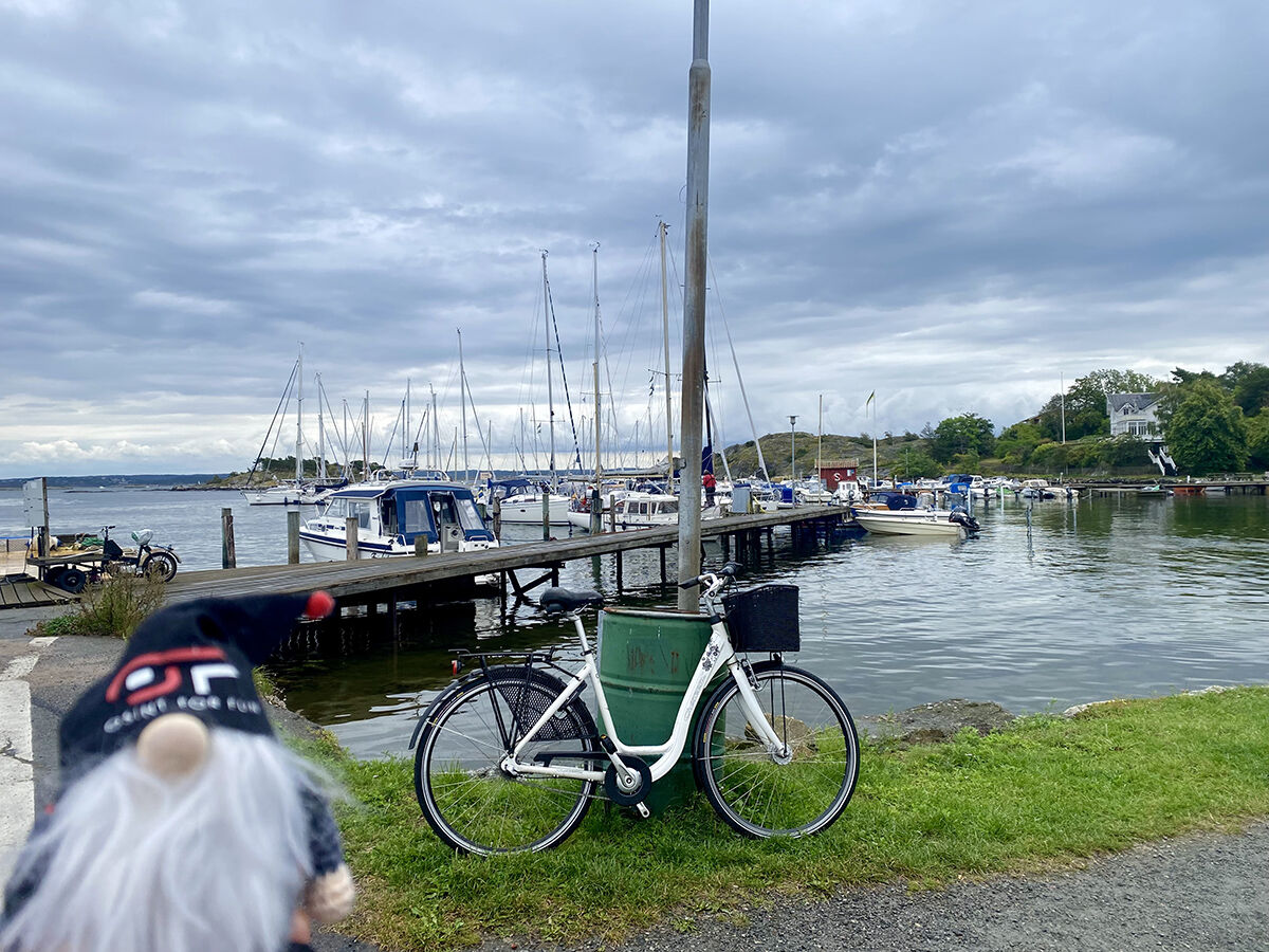
The description reads: "What diversity in this city. Gnosint has just gotten off the ferry after a crossing of barely 20 minutes and he finds this archipelago adorable."
I'd also like to add the fact that the previous image taken in Gothenburg with its description saying: "Gnosint is very sensitive to the charm of the seaside and it is located in the ideal city. But before heading southwest, a little photo in the center."
Pretty safe to say that this archipelago is the Gothenburg Archipelago.
Remember, it took about 20 minutes to get from a port in Gothenburg to the island. Let use that information to search up which islands on the Gothenburg Archipelago take ~20 minutes to get to. We'll start from Saltholmens Brygga since the dotted lines on Google Maps lead us to there from the archipelago.


Definitely not these islands.
We eliminate Vrango and Donso because they take way too long to get to. Makes things a bit easier though still tedious.
What I did was check out all the ports for the rest of the islands, which may have given me more work than others.
This port looks familiar...
This port is in Styrso Bratten.